From Mental Floss [http://www.mentalfloss.com/]
If George Etzel Pearcy had his way,
Lynyrd Skynyrd’s famous song would have been called “Sweet Home Talladego.” In
1973, the California State University geography professor suggested that the
U.S. should redraw its antiquated state boundaries and narrow the overall
number of states to a mere thirty-eight.
Pearcy’s proposed state lines were drawn in less-populated areas, isolating
large cities and reducing their number within each state. He argued that if
there were fewer cities vying for a state’s tax dollars, more money would be
available for projects that would benefit all citizens.
Because the current states were
being chopped up beyond recognition, part of his plan included renaming the new
states by referencing natural geologic features or the region’s cultural
history.
While he did have a rather staunch
support network—economists, geographers, and even a few politicians argued that
Pearcy’s plan might be crazy enough to work—the proposal was defeated in Washington,
D.C. Imagine all the work that would
have to be done to enact Pearcy’s plan: re-surveying the land, setting up new
voter districts, new taxation infrastructure—basically starting the whole
country over. It’s easy to see why the government balked.
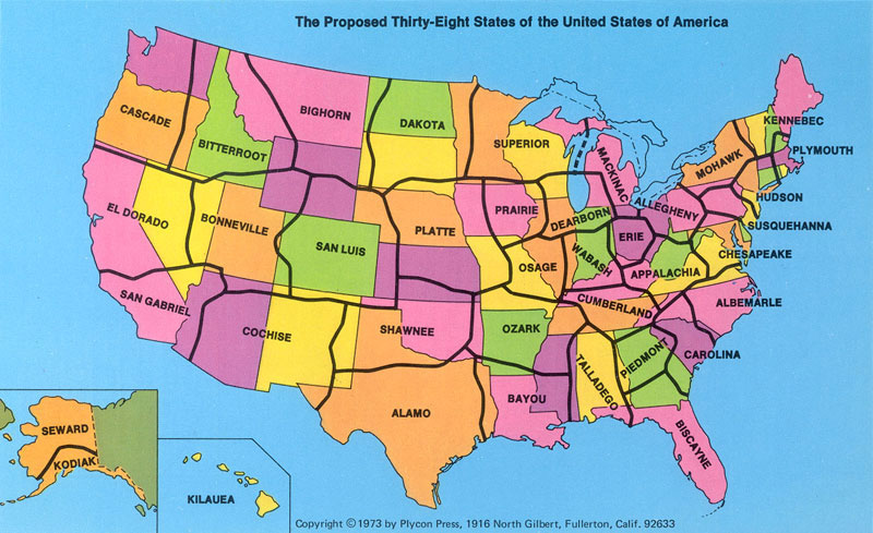
The map above was published in 1973.
Oddly, it doesn’t show any city locations to help illustrate Pearcy’s argument.
At this point, I should tell you that I make maps for a living. So I did my
best to replicate Pearcy’s map using population data from the 2000 census to
show current high population cities and where they would fall within the new
states. Here’s what I came up with:
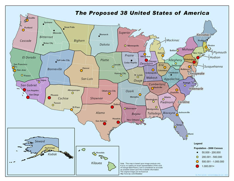
As you can see, many of the new states contain a small number of
major metropolitan areas, and the problem of dual-state cities has been solved.
While Pearcy’s proposal might have been a logistical nightmare to make a
reality, that doesn’t necessarily mean it was a bad idea.